geopandas.GeoSeries.buffer
- GeoSeries.buffer(distance, resolution=16, **kwargs)
Returns a
GeoSeriesof geometries representing all points within a givendistanceof each geometric object.See http://shapely.readthedocs.io/en/latest/manual.html#object.buffer for details.
- Parameters
- distancefloat, np.array, pd.Series
The radius of the buffer. If np.array or pd.Series are used then it must have same length as the GeoSeries.
- resolutionint (optional, default 16)
The resolution of the buffer around each vertex.
Examples
>>> from shapely.geometry import Point, LineString, Polygon
>>> s = geopandas.GeoSeries(
...     [
...         Point(0, 0),
...         LineString([(1, -1), (1, 0), (2, 0), (2, 1)]),
...         Polygon([(3, -1), (4, 0), (3, 1)]),
...     ]
... )
>>> s
0                              POINT (0.00000 0.00000)
1    LINESTRING (1.00000 -1.00000, 1.00000 0.00000,...
2    POLYGON ((3.00000 -1.00000, 4.00000 0.00000, 3...
dtype: geometry
>>> s.buffer(0.2)
0    POLYGON ((0.20000 0.00000, 0.19904 -0.01960, 0...
1    POLYGON ((0.80000 0.00000, 0.80096 0.01960, 0....
2    POLYGON ((2.80000 -1.00000, 2.80000 1.00000, 2...
dtype: geometry
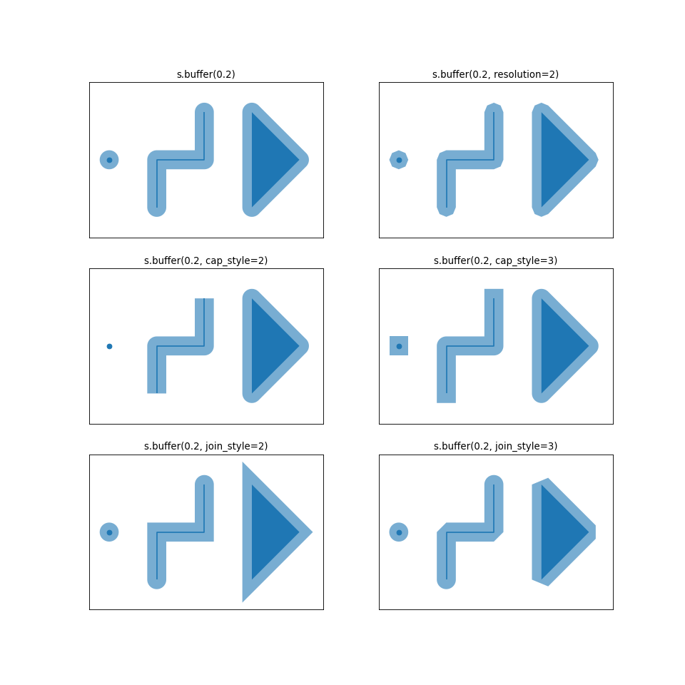
**kwargsaccept further specification asjoin_styleandcap_style. See the following illustration of different options.(Source code, png, hires.png, pdf)
